Somerset · BA20-BA22
Aerial survey of land and sites around Yeovil
Aerial survey in the hamstone country of south Somerset, the most airspace-constrained ground on this list, with quarrying and big estates between.
Airspace comes first here, and it is not a formality
There is significant aviation activity around this town: a military air station a few miles out and an airfield with rotary flying on the edge of the town itself. Between them they make this the most constrained ground covered by this site, and the constraint applies to a good deal of the surrounding countryside as well as to the built-up area.
So a survey here starts with an airspace check and a conversation, not with a flight plan. Where a parcel sits inside a restriction, the quote says what permission is needed and who has to give it. Where clearance is not going to be forthcoming, that gets said plainly rather than being discovered on the day.
Hamstone ground and the workings in it
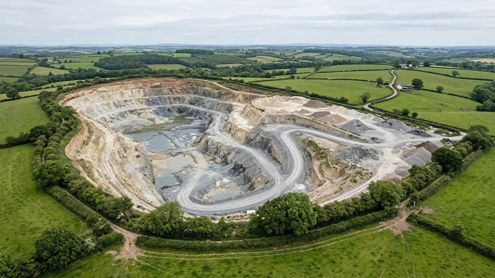
The stone that gives this country its colour is quarried from the hills nearby, and stone workings, active and historic, make good survey subjects: faces, benches, spoil, access and the restored ground around them.
As anywhere with a working face, the requirements are the same. The base surface is agreed before anything is flown, the plan is recorded so a later visit matches, and any figure destined for a formal report needs control set on the ground by a land surveyor rather than trust in the aircraft's own positioning.
Gentle country, which is easy to survey
Away from the ridges this is rolling, workable ground: drier and more sheltered than most of the region, with fields large enough to be efficient and slopes gentle enough that a single flight height serves a whole parcel.
The practical effect is more usable days and shorter visits than the same job would take on the moor edge. Where a survey has to be flown at short notice, this is the sort of country where that is realistic rather than optimistic.
Estates and the parkland around them
There are substantial estates in this part of Somerset, with parkland, woodland belts, lakes and long drives, and they generate the whole-holding work this site is built for: everything captured on one day to one standard, dated, so that next year's set drops alongside it.
The same caution applies as on every parkland job. Mature crowns hide the ground under them, water surfaces do not reconstruct, and a picture of a designed landscape is a record rather than a plan unless it has been tied to control.
Ridges that catch the wind
The ridges south of the town are exposed in a way the vale is not, and they catch wind that never reaches the lower ground. It is a smaller effect than the moor edge produces, but it is enough to make a difference to a survey planned for a marginal day.
The habit is the same as everywhere: check the wind at height rather than at the gate, and treat a gusty average as worse than a steady one at the same speed.
Industrial ground and laydown areas
This is a manufacturing town, and manufacturing ground brings its own survey work: yards, laydown areas, car parking, storage compounds and the access routes serving them, all of which change layout more often than anyone documents.
One capture puts the whole site on file with a date attached. Where material or plant is moving through a compound, repeat captures on the same plan give the difference between one month and the next, measured against a base surface agreed at the start rather than estimated afterwards.
Behind the survey
What Yeovil clients are actually buying
Registered operator
CAA registered, with an Operator ID and a Flyer ID held. Both are checkable, and any land agent or consultant is welcome to ask for them before a flight is booked.
A2 Certificate of Competency
The A2 CofC, which is what governs how close the aircraft may work to people who are not part of the job. No GVC is held, so operations are planned inside the A2 CofC.
Aircraft
A DJI Mavic 4 Pro carrying a 100 megapixel Hasselblad camera and 6K video, and a DJI Mavic 2 Enterprise Advanced with a 640 by 512 radiometric thermal camera.
Insurance
Insured with Coverdrone for commercial operations. A certificate goes to your office before the visit if your site induction needs one on file.
Nearby
Also covered around Yeovil
- SherborneAerial survey in the Yeo valley, designed parkland and hamstone estate country, where low winter sun does more for an earthwork than any amount of processing.
- DorchesterAerial survey on the Dorset chalk, where buried features show as marks in a dry summer and water meadows read as engineering from above.
- TauntonAerial survey across the Vale of Taunton Deane: big flat parcels and constant development ground, drier than Devon but with vale fog in the mornings.
Tell us the output you need
Request a quote in Yeovil
Send the address and what is worrying you. Sam Hembury will come back with a fixed price and the next slot that suits the weather.