Devon · EX1-EX6
Aerial survey of land and sites around Exeter
Aerial survey around Exeter: Clyst valley floodplain, the estuary head and the development land east of the city, close to restricted airspace.
Airspace is the first question in Exeter, not the last
Exeter Airport sits east of the city, and the flight restriction zone around it covers a good deal of the ground where survey work is wanted: the Clyst valley, the Pinhoe and Cranbrook growth corridor and the approaches towards the estuary. That is not a reason to refuse a job, but it is a reason to settle the question before anything is priced rather than to turn up hopeful.
So a survey of a parcel on that side of the city begins as a desk exercise. Where the ground falls inside the zone, permission has to be arranged with the aerodrome and that takes the time it takes. Where it falls outside, the flight plans like anywhere else. Either way you get told which of those two you are dealing with when the quote arrives.
The wet ground east and south of the city
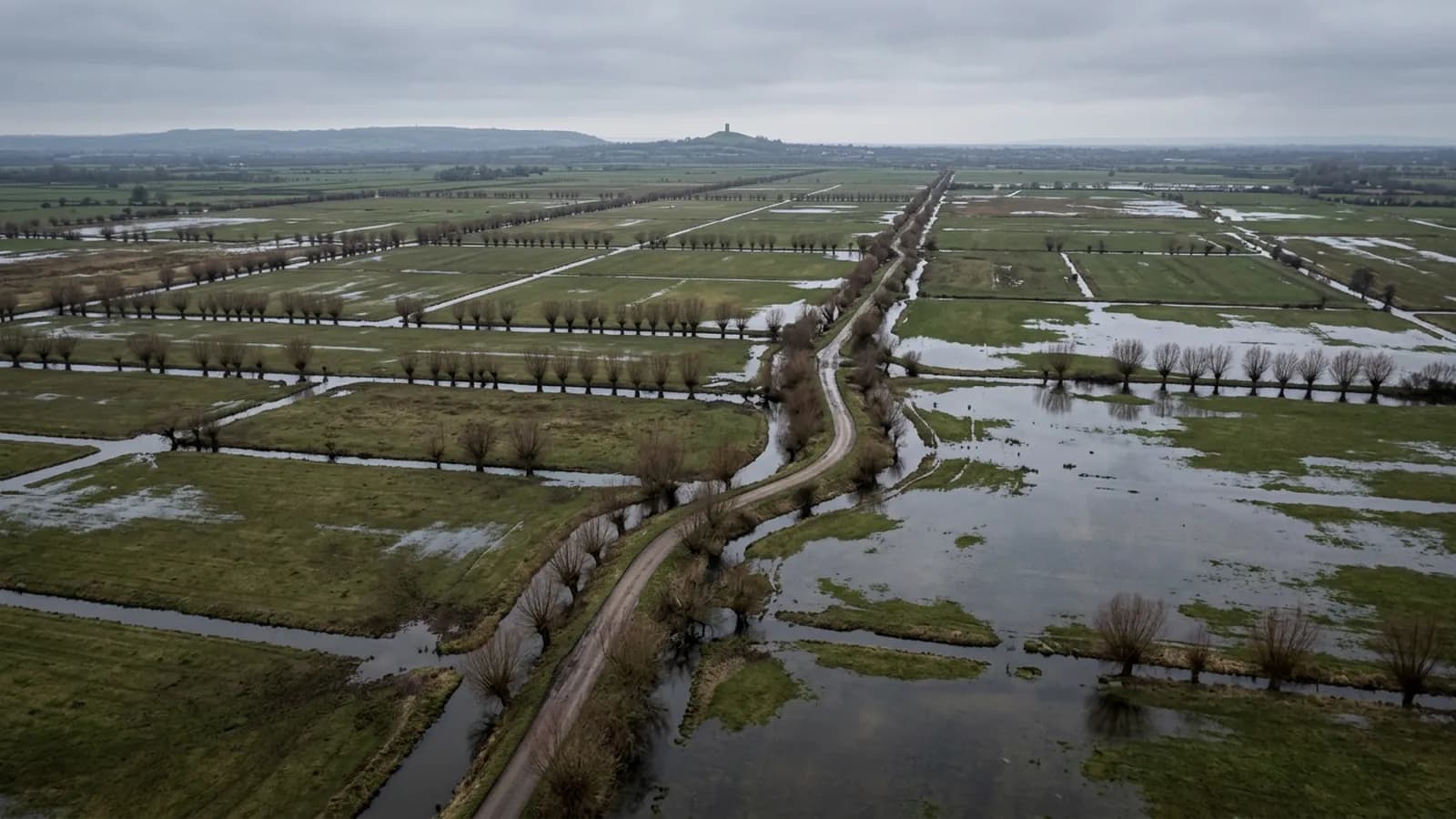
The city sits on a low ridge above the tidal head of the Exe, and the ground falls away east into the Clyst valley. That is flat, wet, ditched land: grazing marsh, drainage channels, willow along the water and standing water in the fields for a good part of the winter.
For an aerial survey, that ground behaves in a particular way. Standing water reconstructs badly or not at all, because a water surface gives the camera nothing to match between frames, so a winter flight over the levels comes back with gaps where the water was. Where the survey is about drainage, that is useful information rather than a fault. Where it is about ground levels, the answer is to fly the parcel in a dry spell and to say plainly in the report which parts were under water on the day.
Development land and the value of a dated record
Most of the growth around Exeter is to the east, and development parcels change hands, change use and change shape faster than anything else in the county. A photograph of a field taken before a contractor moves onto it, square on and with a date attached, settles arguments that otherwise run on memory.
That is the most common request here: capture the parcel now, capture it again at handover, and keep both. It costs little beside the value of the ground and it is the one record nobody can go back and take later.
Working out of the city
Exeter is where this business is based, so a survey inside the ring road or in the surrounding parishes is a short run, and a morning flight can be processing by the afternoon. Marsh Barton, Sowton and the Alphington side are all inside a few minutes of the office.
The city is also sheltered compared with the coast, which lengthens the usable flying window through the winter. Rainfall is still above the England average and the valley holds damp air, so a wet week can shut the door on a survey here as easily as anywhere else in Devon.
Behind the survey
What Exeter clients are actually buying
Registered operator
CAA registered, with an Operator ID and a Flyer ID held. Both are checkable, and any land agent or consultant is welcome to ask for them before a flight is booked.
A2 Certificate of Competency
The A2 CofC, which is what governs how close the aircraft may work to people who are not part of the job. No GVC is held, so operations are planned inside the A2 CofC.
Aircraft
A DJI Mavic 4 Pro carrying a 100 megapixel Hasselblad camera and 6K video, and a DJI Mavic 2 Enterprise Advanced with a 640 by 512 radiometric thermal camera.
Insurance
Insured with Coverdrone for commercial operations. A certificate goes to your office before the visit if your site induction needs one on file.
Nearby
Also covered around Exeter
- CreditonAerial survey across the Creedy valley, productive Mid Devon farmland where steep sides and long parcels decide how a flight has to be planned.
- CullomptonAerial survey in the Culm valley: flat ground by the motorway, development land and industrial estates among working farms, and fog that sets the start time.
- Newton AbbotAerial survey in the Bovey basin and the Teign floodplain, clay working country where the water level in a pit decides what can actually be measured.
Tell us the output you need
Request a quote in Exeter
Send the address and what is worrying you. Sam Hembury will come back with a fixed price and the next slot that suits the weather.