Devon · TQ12
Aerial survey of land and sites around Newton Abbot
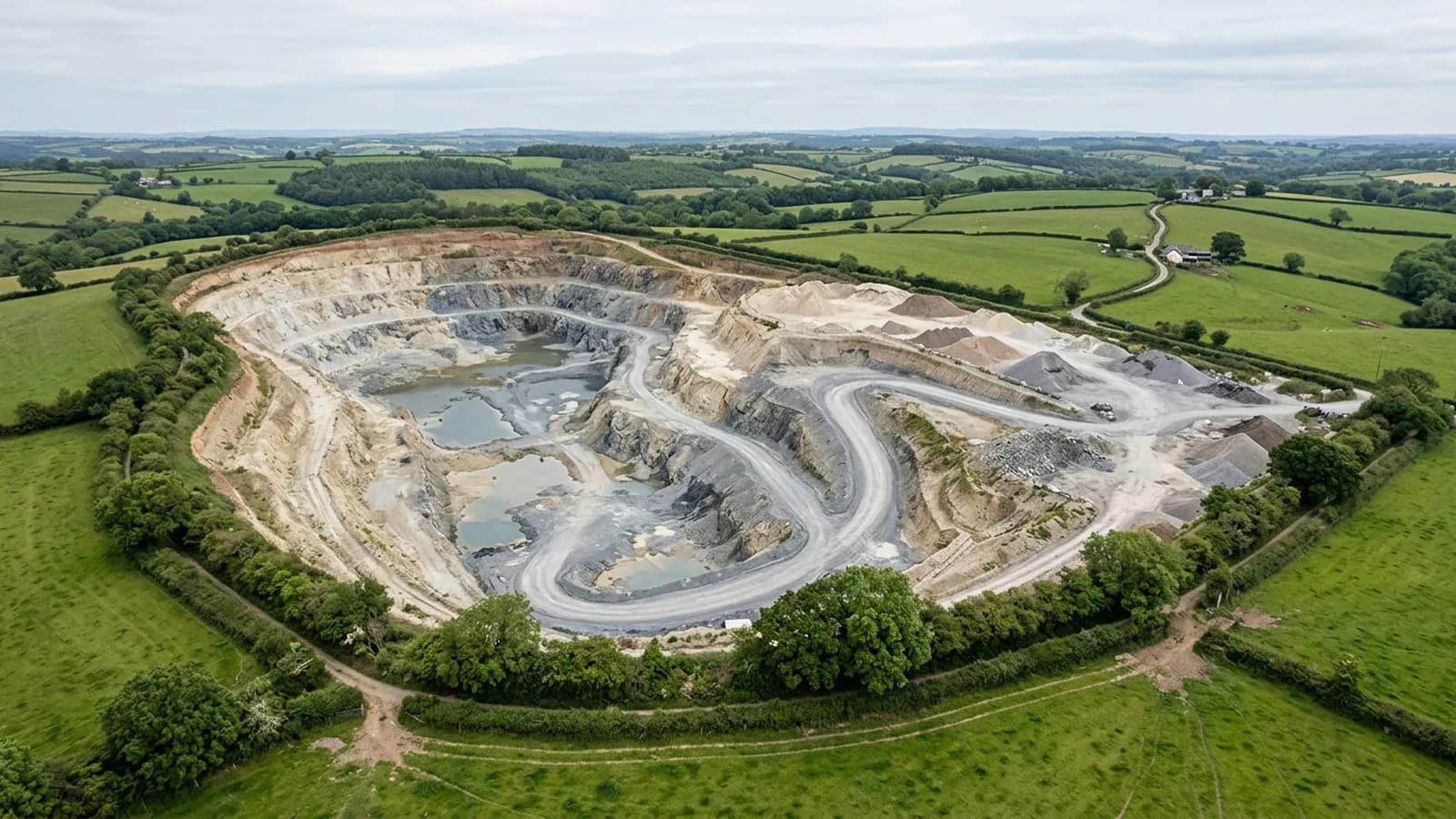
Aerial survey in the Bovey basin and the Teign floodplain, clay working country where the water level in a pit decides what can actually be measured.
Pits, and the surface you can measure
The clay workings north-west of the town are the defining ground here, and a pit is a harder subject than a stockpile. The sides are steep, the floor is often wet, and the working surface changes shape faster than a quarry face does.
What can be measured is everything the camera can see from above the rim and inside the excavation. What cannot is anything below standing water, and on a clay floor after a wet fortnight that can be a large share of the base. So the survey reports the surface it captured and marks the water line on the day, rather than interpolating a floor that nobody photographed.
Restored and backfilled ground
Alongside the working sites there is a long history of restored and part-restored ground: old pits filled, capped, planted or turned over to water and amenity. Settlement, drainage and vegetation on that ground are all things people want measured over time.
That is repeat survey work of the most useful kind. The first flight is the datum, every later one is flown on the same plan, and the difference between them is the answer. Where a formal figure is going into a report, control on the ground set by a land surveyor is what makes it defensible, and the report says whether it was there.
Floodplain ground and mist off the Teign
The town sits on flat ground where the Teign becomes tidal, and low-lying damp ground produces mist that sits until mid-morning on a still day. The forecast rarely mentions it and it is the most common reason a first-thing start gets pushed back an hour or two.
The flat ground itself is easy to fly: consistent height, even detail, predictable coverage. The awkward part of the basin is the ring of hills around it, where a parcel on the slope needs planning quite differently from the floodplain it looks down on.
Development land on the edges
There is substantial modern development around this town, and development ground generates the same two requests everywhere: a dated record of the parcel before anything moves, and volumes between surfaces once it does.
Both are straightforward as long as the base surface is agreed before the first flight and the plan is written down. What causes arguments later is a second survey flown at a different height on a different pattern, which is exactly what a recorded plan prevents.
Racecourse, parkland and other large flat sites
Large flat managed sites are good aerial subjects: the whole thing fits in one capture, the surface is even, and drainage problems that are invisible from ground level show up as clear patterns from above after rain.
The constraint on any site with people on it is separation. The A2 Certificate of Competency sets how close the aircraft may work to people who are not part of the job, so a busy site is flown out of hours or in sections, and the report says which parts were captured when.
Behind the survey
What Newton Abbot clients are actually buying
Registered operator
CAA registered, with an Operator ID and a Flyer ID held. Both are checkable, and any land agent or consultant is welcome to ask for them before a flight is booked.
A2 Certificate of Competency
The A2 CofC, which is what governs how close the aircraft may work to people who are not part of the job. No GVC is held, so operations are planned inside the A2 CofC.
Aircraft
A DJI Mavic 4 Pro carrying a 100 megapixel Hasselblad camera and 6K video, and a DJI Mavic 2 Enterprise Advanced with a 640 by 512 radiometric thermal camera.
Insurance
Insured with Coverdrone for commercial operations. A certificate goes to your office before the visit if your site induction needs one on file.
Nearby
Also covered around Newton Abbot
- TotnesAerial survey across the South Hams around Totnes, estate and tenanted farmland on the tidal Dart, where a holding is usually several parcels in several hands.
- ExeterAerial survey around Exeter: Clyst valley floodplain, the estuary head and the development land east of the city, close to restricted airspace.
Tell us the output you need
Request a quote in Newton Abbot
Send the address and what is worrying you. Sam Hembury will come back with a fixed price and the next slot that suits the weather.