Devon · EX16
Aerial survey of land and sites around Tiverton
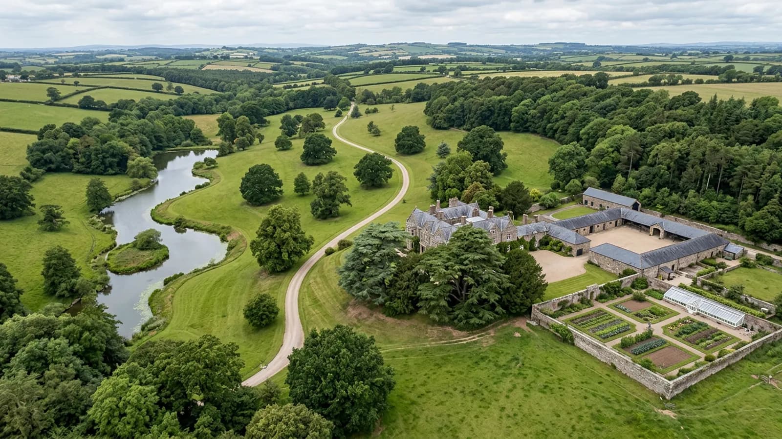
Aerial survey around Tiverton, from estate parkland and the canal corridor to steep-sided Exe valley farms, in the wettest part of Mid Devon.
Parkland is not the same job as farmland
There is significant parkland in this parish, and parkland behaves differently from a field under the camera. Mature standing trees in cropped grass throw large moving shadows, hold their own canopy well above the ground, and hide whatever sits underneath them.
A surface model of parkland is therefore a model of the tree tops and the grass between them, and no processing produces the ground beneath a full crown. For most estate work that is fine, because the questions are about extent, condition, drives, drainage and the state of the grass. Where levels under a canopy have to be measured, that is laser scanning work rather than photography, and it is better to hear that at the quote than after the invoice.
The canal is a corridor, not a block
The Grand Western Canal runs through here as a long thin feature, and a long thin feature needs a different flight from a square parcel. A corridor survey is flown as a strip with overlap along its length and enough width either side to hold the banks, the towpath and the ground behind them.
Anything linear behaves that way: a canal, a leat, a hedge line under dispute, a length of track, a pipeline route. The frame count climbs with the distance rather than the area, so a mile of corridor and a compact field of the same acreage are quite different jobs to price.
Steep ground above the Exe and the Lowman
Tiverton sits where the Lowman meets the Exe on ground that climbs sharply north and west, and the farms above the town are on genuine slopes. As on the Creedy, a survey planned flat over that gets uneven ground detail and, at the top of a rise, less clearance than the plan assumed.
The other thing slope does is fill the frame with shade. A north-facing valley side in winter can sit in shadow for most of the short flying day, and shadow is missing information as far as the model is concerned. On the steep holdings here, the time of day is part of the plan.
A wet corner of Devon
This stretch of the Exe valley is notably wet, well above the county average, which shortens the number of days a survey can actually be flown. Nothing about that is solved by turning up anyway.
The practical answer is a booking that carries a fallback date, and a willingness to take a good day when it appears. Repeat sites are easier still: the plan is already written down, so a return visit can be flown at short notice whenever the weather opens.
School and institutional grounds
Alongside the farms and the estate land there are large institutional grounds in this town, which bring their own considerations. Playing fields, drives, car parks, mature trees and a lot of people who are not part of the survey, all on one site.
The A2 Certificate of Competency governs how close the aircraft may work to people who are not involved in the job, so on ground like that the answer is timing rather than technique: fly out of hours, or fly the sections that are clear and come back for the rest. Where a site cannot be cleared at all, that is said before the visit is booked.
Behind the survey
What Tiverton clients are actually buying
Registered operator
CAA registered, with an Operator ID and a Flyer ID held. Both are checkable, and any land agent or consultant is welcome to ask for them before a flight is booked.
A2 Certificate of Competency
The A2 CofC, which is what governs how close the aircraft may work to people who are not part of the job. No GVC is held, so operations are planned inside the A2 CofC.
Aircraft
A DJI Mavic 4 Pro carrying a 100 megapixel Hasselblad camera and 6K video, and a DJI Mavic 2 Enterprise Advanced with a 640 by 512 radiometric thermal camera.
Insurance
Insured with Coverdrone for commercial operations. A certificate goes to your office before the visit if your site induction needs one on file.
Nearby
Also covered around Tiverton
- CullomptonAerial survey in the Culm valley: flat ground by the motorway, development land and industrial estates among working farms, and fog that sets the start time.
- CreditonAerial survey across the Creedy valley, productive Mid Devon farmland where steep sides and long parcels decide how a flight has to be planned.
- ExeterAerial survey around Exeter: Clyst valley floodplain, the estuary head and the development land east of the city, close to restricted airspace.
Tell us the output you need
Request a quote in Tiverton
Send the address and what is worrying you. Sam Hembury will come back with a fixed price and the next slot that suits the weather.