Devon · EX38
Aerial survey of land and sites around Great Torrington
Aerial survey around Torrington, clay working country on a hilltop bluff, with commons, steep wooded slopes and public access all in the same few square miles.
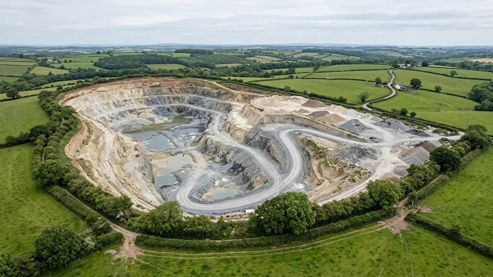
Clay ground and working pits
The country west and south of this town is clay ground with a long working history, and extraction sites bring the most exacting version of this work: surfaces that have to be captured repeatably, faces that move month to month, and figures that end up in somebody's reporting.
The discipline on those is fixed. Agree what each volume is measured against before anything is flown, write the flight plan down so the next visit matches this one, and keep the toe of every pile and face visible so the measurement has a defined bottom. Where a formal figure is needed, control set by a land surveyor belongs on the site, and the report says whether it was there.
Standing above everything, with wind from every direction
The town sits on a bluff above a loop of the Torridge with the ground falling away on three sides, which leaves it exposed to wind from any quarter rather than one prevailing direction. Shelter that works on a westerly is no help at all on a northerly.
For flying that means checking the wind on the day and from the right direction rather than assuming a sheltered corner will do. It also means the ground itself has a lot of vertical range in a short distance, so a plan drawn flat over the bluff and the valley floor together will not serve both.
Wooded slopes hide the ground under them
Steep wooded slopes fall away from the town on three sides, and woodland is the hardest ground for a camera-based survey. Under a closed canopy the model follows the tops of the trees, and filtering it towards bare earth on that kind of slope produces an estimate rather than a measurement.
So a survey here is clear about which parts of the parcel it can speak for. Open ground, tracks, rides, the edge of the wood and any clearing all model properly. Ground under full crown does not, and if levels under the trees are the point, that is a laser scanning job rather than this one.
Commons, footpaths and people who are not part of the job
The commons around the town are open access land and well used, and the A2 Certificate of Competency governs how close the aircraft may work to people who are not involved in the survey. On busy ground that becomes a timing question rather than a technical one.
Early mornings, weekdays and out of season all help. Where a parcel cannot be cleared of people at all, the flight is planned around the parts that can be, and the report says which sections were left. Nobody benefits from a survey flown too close to a dog walker.
Designed landscapes and visitor sites
There are formal gardens and visitor attractions in this parish, and designed landscapes make good aerial subjects: the layout, the paths, the beds, the drainage and the car parking all read at once from above in a way they never do at ground level.
The constraints are the ordinary ones. Visitors are uninvolved people, so timing matters; mature specimen trees hide the ground beneath them; and anything sold as a plan of a designed landscape should be measured against control rather than flown loose.
Behind the survey
What Great Torrington clients are actually buying
Registered operator
CAA registered, with an Operator ID and a Flyer ID held. Both are checkable, and any land agent or consultant is welcome to ask for them before a flight is booked.
A2 Certificate of Competency
The A2 CofC, which is what governs how close the aircraft may work to people who are not part of the job. No GVC is held, so operations are planned inside the A2 CofC.
Aircraft
A DJI Mavic 4 Pro carrying a 100 megapixel Hasselblad camera and 6K video, and a DJI Mavic 2 Enterprise Advanced with a 640 by 512 radiometric thermal camera.
Insurance
Insured with Coverdrone for commercial operations. A certificate goes to your office before the visit if your site induction needs one on file.
Nearby
Also covered around Great Torrington
- BidefordAerial survey on the Torridge, from dune and burrows ground at the estuary mouth to steep bank slopes and working quaysides, all of it in salt air.
- BarnstapleAerial survey around the tidal Taw, where the tide decides when intertidal ground can be captured and estuary wind decides whether it happens at all.
- HolsworthyAerial survey across the Culm Measures plateau of north-west Devon, big farm country where heavy clay makes winter ground access poor and the wind rarely stops.
- OkehamptonAerial survey on the northern edge of Dartmoor, where military range days and some of the worst weather in the county decide what can be flown, and when.
Tell us the output you need
Request a quote in Great Torrington
Send the address and what is worrying you. Sam Hembury will come back with a fixed price and the next slot that suits the weather.