Aerial Survey
Volume and stockpile surveys
Repeat flights over quarries, aggregate yards, clamps and fill, measuring the difference between one captured surface and the next.
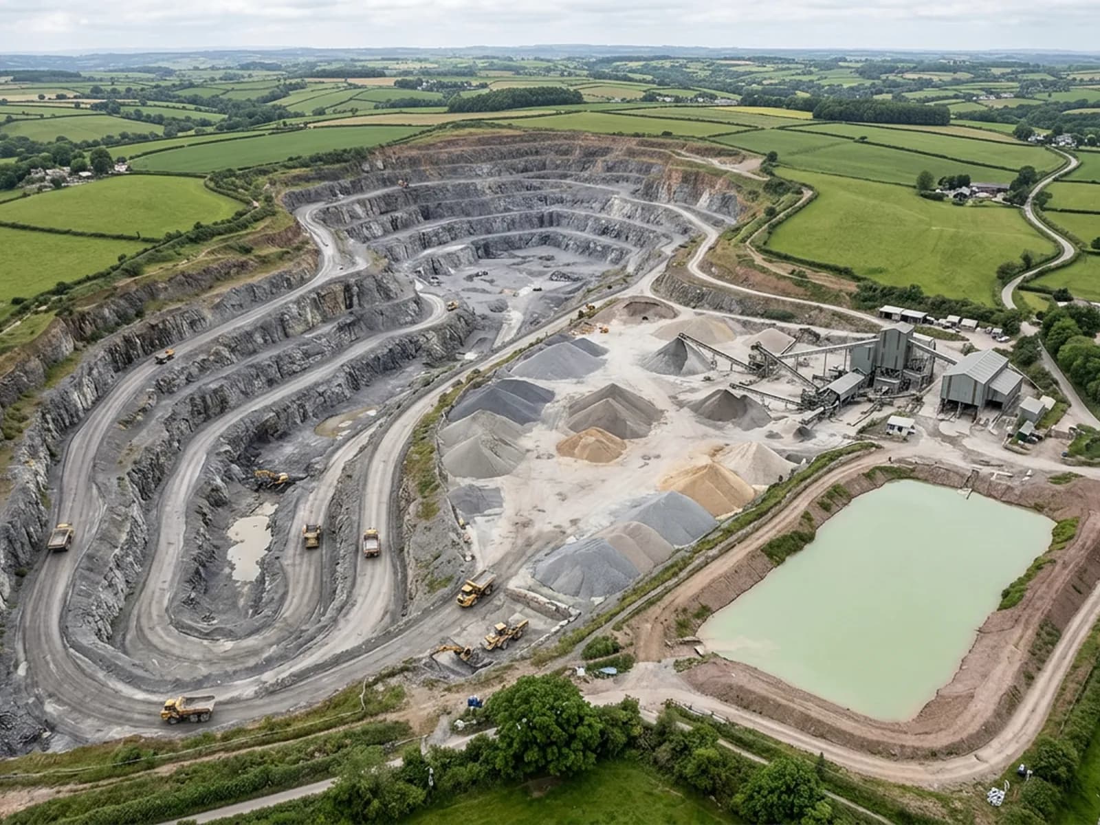
A volume is not measured directly. It is worked out as the space between two surfaces: a stockpile against the hardstanding it sits on, this month's face against last month's, an excavation against the level it started from.
Which means the survey is really about capturing surfaces cleanly and repeatably. Fly the same plan at the same height each time, keep the toe of every pile visible, and the comparison between visits carries meaning. Change the height and the pattern between visits and it does not.
This is quarry, pit and aggregate work, muck and silage on farms, fill and cut on groundworks sites, and cell capacity on waste sites. It is also the service where the limits matter most, so they are set out here rather than in the small print.
What is included
- A repeatable flight plan, recorded so the next visit can be flown the same way
- Surface models of each pile, face or cell captured on the visit
- Volumes calculated between the captured surface and the base or previous surface agreed with you
- The orthomosaic of the yard or working area alongside the volume figures
- A written statement of the base surface used, because a volume means nothing without it
- Comparison against a previous survey where we have flown the site before
- The report inside 48 hours, with the frames it was built from
We measure shape, you supply density
What a survey produces is the space a material occupies. Turning that into tonnes needs a density, and turning loose material back into solid needs a bulking factor. Both belong to the operator and the material, not to the aircraft, and both change with moisture, grading and how the pile was built.
So the figures we hand over are volumes, with the base surface stated. If your reporting is in tonnes, apply your own factors to those volumes, or send us the factor you use and we will show the conversion with the assumption written next to it.
What makes a pile hard to measure
Piles pushed against a wall or into a bay hide their own footprint. Piles that merge into their neighbours have no clear edge. Very fine dry material sits at an angle that a camera reads well; wet material that has slumped or been driven over does not read as cleanly.
Standing water on a yard, deep shadow between piles at the wrong time of day, and plant parked across the working area all take ground out of the model. None of these stop the job, but all of them belong in the report, because a volume with a hidden toe reads exactly like a volume without one unless somebody says.
Comparison is the real product
A single volume figure is a number that has to be trusted. Two surveys of the same site flown the same way give you a difference, and a difference is checkable: it should match what went out on the weighbridge, near enough, or something needs explaining.
That is why the flight plan for a repeat site is written down and kept. It is also why the base surface is agreed once and reused rather than re-estimated every visit.
On the day
How a volumes runs
- Step 1
Agree the base
Before anything is flown we agree what each volume is measured against: a hardstanding level, a previous survey, or a design surface you supply.
- Step 2
Set the plan once
Height, line spacing and overlap are fixed for the site and written down, so every later visit is flown the same way and the numbers can be compared.
- Step 3
Clear the toes
Piles that run into each other, or into a wall, hide the ground where the volume ends. We flag that at the visit, and where it matters we ask for piles to be pulled apart before the next one.
- Step 4
Fly and process
The working area is captured, the surfaces built and the volumes calculated between the agreed surfaces.
- Step 5
Report with the assumptions on the front
Figures come with what they were measured against and what was in the way. Anyone can then check the assumption rather than taking the number on trust.
Behind the work
Kit, cover and qualifications
Registered operator
CAA registered, with an Operator ID and a Flyer ID held. Both are checkable, and any land agent or consultant is welcome to ask for them before a flight is booked.
A2 Certificate of Competency
The A2 CofC, which is what governs how close the aircraft may work to people who are not part of the job. No GVC is held, so operations are planned inside the A2 CofC.
Aircraft
A DJI Mavic 4 Pro carrying a 100 megapixel Hasselblad camera and 6K video, and a DJI Mavic 2 Enterprise Advanced with a 640 by 512 radiometric thermal camera.
Insurance
Insured with Coverdrone for commercial operations. A certificate goes to your office before the visit if your site induction needs one on file.
Volumes
Volume and stockpile surveys questions
- Can you give a figure accurate enough for royalty or stock reporting?
- That is a question about control, not about drones. Where the number is going into a formal report, control points set and recorded by a land surveyor should be on the site, and the survey flown to them. We will fly to control that somebody else has set, or capture the site without it and say plainly in the report that it was flown without.
- How often should a working site be flown?
- As often as the reporting needs it and no more. Monthly suits a site with steady throughput, quarterly suits slower ones. What matters is that each visit is flown on the same plan so the differences mean something.
- Can you survey a cell or a void rather than a pile?
- Yes, the arithmetic is the same in reverse: the space between the captured surface and a base or design surface. The practical limits are the same too, so anything the camera cannot see, including under standing water, is stated rather than estimated.
Where
Volume and stockpile surveys across the South West
Also on this site
Tell us the output you need
Request a quote with Aerial Survey
Send the boundary or the postcode and the output you need. Sam Hembury comes back with a fixed price, a date and anything in the brief that needs settling first.