Devon · EX17
Aerial survey of land and sites around Crediton
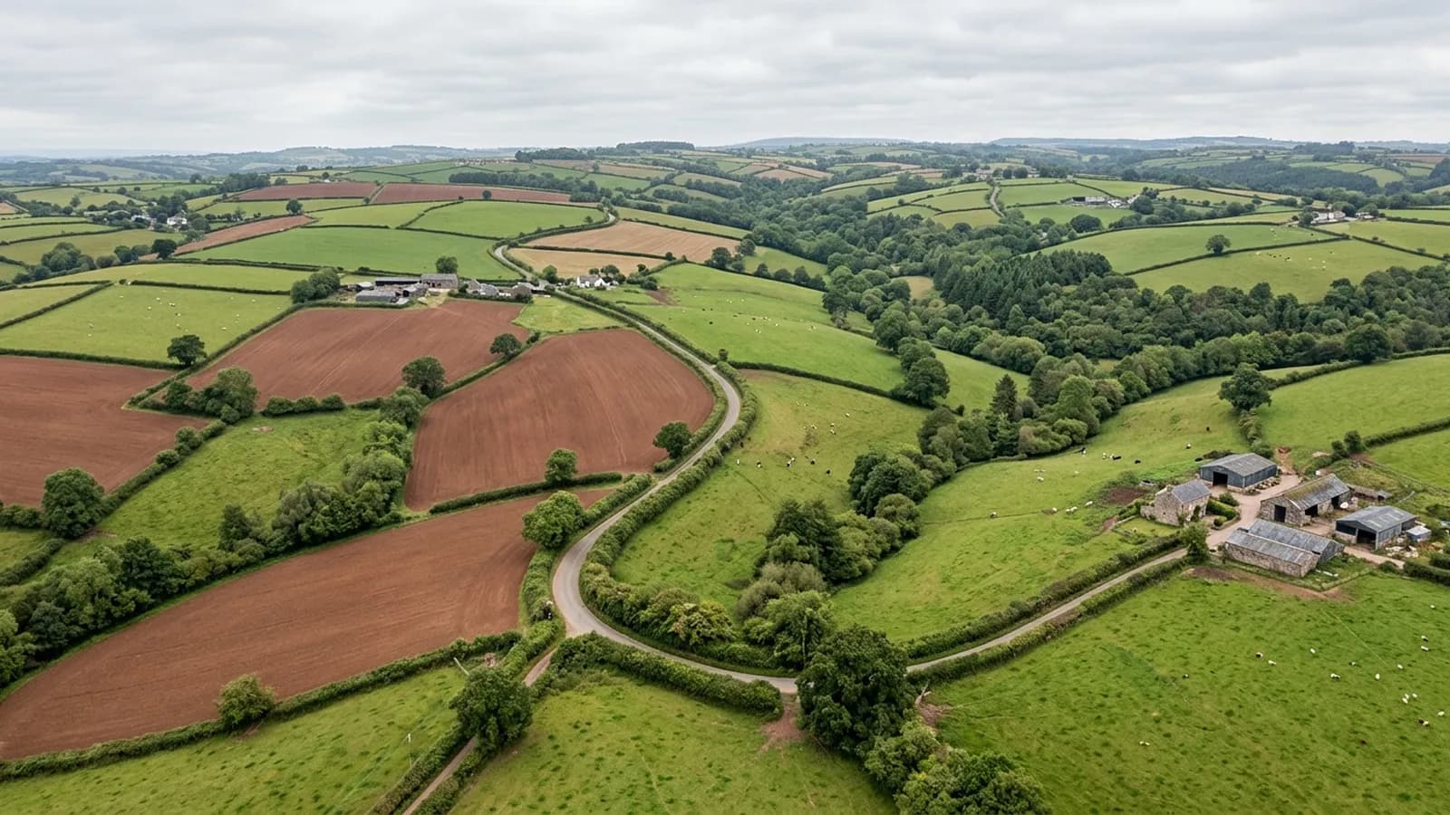
Aerial survey across the Creedy valley, productive Mid Devon farmland where steep sides and long parcels decide how a flight has to be planned.
Steep sides change how a survey is flown
The town sits in the Creedy valley with sandstone hills rising on both sides, and a great many of the farms here run up those sides rather than sitting on a level block. That matters more than it sounds. A flight held at a constant height above its take off point gets steadily closer to the ground as the land rises, and steadily further away as it falls.
The effect is uneven detail across a single parcel and, on the worst of it, a safety question at the top of the slope. The fix is terrain-aware planning or splitting the parcel into separate runs with their own take off heights. On a steep Crediton holding, that decision is made at the planning stage, and it is one of the reasons a price is not quoted off an acreage figure alone.
Red soil is good ground to photograph
The bare red earth of this valley is a gift to photogrammetry. A model is built by matching the same features across overlapping frames, and worked red soil carries plenty of texture for that: tramlines, clod, plough furrows, the change from headland to body of the field.
Compare that with a smooth green ley in flat light, which offers the software far less to lock onto. So on mixed holdings around Crediton, the ploughed ground models cleanly, and the ley and the standing crop are the parts where the surface follows the top of the vegetation instead of the earth beneath it. Where levels matter, the window after harvest is worth waiting for.
Farm holdings that are not in one piece
Very few farms here are a single block. A typical holding is a home farm with outlying parcels a mile or two off, taken on at different times, sometimes across a road or a parish boundary. A whole-holding survey therefore means several separate flights in one day rather than one long grid.
That is worth saying at the quoting stage, because it changes the shape of the visit. Each parcel needs its own take off point, its own approach and its own set of frames, and the day is planned around the driving as much as the flying.
Estate ground and old field patterns
There is estate land in this parish as well as working farms, and the older field patterns around the Creedy carry banks, sunken lanes and hedge lines that predate anything on a modern plan. An orthomosaic shows those as they actually sit rather than as the deed plan draws them, which is regularly the useful part for an agent.
The one thing it will not do is settle a boundary. What it gives you is a measurable, dated picture of what is on the ground, which is the thing a chartered surveyor or a solicitor then works from.
Getting kit to the take off point
The lanes around this valley are narrow, banked on both sides and often wet, and a good many gateways sit below the level of the road. None of that stops a survey, but it does decide where a vehicle can be left and how far the kit has to be carried to reach a sensible launch position.
It is worth a line in the first message: whether there is hard standing anywhere on the holding, whether the gate takes a vehicle in a wet January, and whether stock are in the field the take off point would sit in. Those three answers shape a visit here more than the acreage does.
Behind the survey
What Crediton clients are actually buying
Registered operator
CAA registered, with an Operator ID and a Flyer ID held. Both are checkable, and any land agent or consultant is welcome to ask for them before a flight is booked.
A2 Certificate of Competency
The A2 CofC, which is what governs how close the aircraft may work to people who are not part of the job. No GVC is held, so operations are planned inside the A2 CofC.
Aircraft
A DJI Mavic 4 Pro carrying a 100 megapixel Hasselblad camera and 6K video, and a DJI Mavic 2 Enterprise Advanced with a 640 by 512 radiometric thermal camera.
Insurance
Insured with Coverdrone for commercial operations. A certificate goes to your office before the visit if your site induction needs one on file.
Nearby
Also covered around Crediton
- ExeterAerial survey around Exeter: Clyst valley floodplain, the estuary head and the development land east of the city, close to restricted airspace.
- TivertonAerial survey around Tiverton, from estate parkland and the canal corridor to steep-sided Exe valley farms, in the wettest part of Mid Devon.
- OkehamptonAerial survey on the northern edge of Dartmoor, where military range days and some of the worst weather in the county decide what can be flown, and when.
- BarnstapleAerial survey around the tidal Taw, where the tide decides when intertidal ground can be captured and estuary wind decides whether it happens at all.
Tell us the output you need
Request a quote in Crediton
Send the address and what is worrying you. Sam Hembury will come back with a fixed price and the next slot that suits the weather.