Devon · EX22
Aerial survey of land and sites around Holsworthy
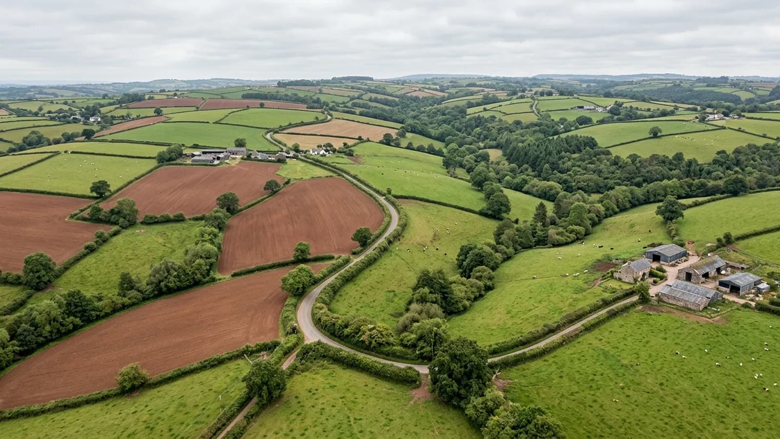
Aerial survey across the Culm Measures plateau of north-west Devon, big farm country where heavy clay makes winter ground access poor and the wind rarely stops.
You do not have to drive on the ground to survey it
This is heavy clay country. From November to March a loaded vehicle crossing a field leaves ruts that are still there in June, and getting plant onto a wet holding is a decision with consequences rather than a formality.
An aerial survey needs one firm take off point and nothing else. The parcel gets captured from above without a wheel going on it, which on this ground is not a minor advantage. It is regularly the reason the job happens in February rather than waiting for the summer.
Holdings large enough to need planning
Farms here run to a size that changes how a survey is organised. A block that would be one flight in Mid Devon is several here, and a whole holding can be most of a day even before the driving between parcels.
So the price is built from the flight time and the number of separate runs rather than from a headline acreage. That gets settled at the quote, with a clear line on whether the whole holding fits into one visit or whether it splits sensibly into two, and what each one covers.
Wind is the limiting factor, not rain
There is nothing between this plateau and the Atlantic, and the wind shows it. Rain stops a flight for an hour or two; wind above the aircraft limit stops it for the day, and the days it does that are common here through the winter.
Bookings are therefore made with a fallback, and repeat sites are flown at short notice when a settled morning turns up. Anyone who tells you they can hold a date on this plateau three weeks out is telling you what you want to hear.
Grassland, ditches and the shape of a wet farm
The Culm grassland that gives this country its character is wet, rushy, species-rich ground, and it photographs as a mosaic: rushes, purple moor grass, scrub creeping in along the ditches. From above, the pattern of what is wet, what is drying and where the scrub is winning is far easier to read than it is from the gateway.
The same flight picks up the ditch and culvert network, the tracks and the gateways that have poached out. None of that is an ecological assessment or a management prescription, and the report does not pretend otherwise: it is a current, dated, measurable picture that your agent or ecologist can then work from.
Sheds, yards and the stock buildings
The proportion of large agricultural sheds around this town is unusually high, and their roofs and yards form a big part of what a holding record actually shows: sheeting, ridge lines, gutters and downpipes, the concrete apron, the slurry store, where water runs when the yard is full.
A survey covers all that as part of the same capture. If a building needs proper inspecting rather than recording, that is a separate job with a different site in this group, and the report says which of the two you have got.
Behind the survey
What Holsworthy clients are actually buying
Registered operator
CAA registered, with an Operator ID and a Flyer ID held. Both are checkable, and any land agent or consultant is welcome to ask for them before a flight is booked.
A2 Certificate of Competency
The A2 CofC, which is what governs how close the aircraft may work to people who are not part of the job. No GVC is held, so operations are planned inside the A2 CofC.
Aircraft
A DJI Mavic 4 Pro carrying a 100 megapixel Hasselblad camera and 6K video, and a DJI Mavic 2 Enterprise Advanced with a 640 by 512 radiometric thermal camera.
Insurance
Insured with Coverdrone for commercial operations. A certificate goes to your office before the visit if your site induction needs one on file.
Nearby
Also covered around Holsworthy
- BidefordAerial survey on the Torridge, from dune and burrows ground at the estuary mouth to steep bank slopes and working quaysides, all of it in salt air.
- Great TorringtonAerial survey around Torrington, clay working country on a hilltop bluff, with commons, steep wooded slopes and public access all in the same few square miles.
- LauncestonAerial survey either side of the Tamar in east Cornwall, high open farmland with big holdings, industrial ground by the trunk road and weather off two moors.
Tell us the output you need
Request a quote in Holsworthy
Send the address and what is worrying you. Sam Hembury will come back with a fixed price and the next slot that suits the weather.