Cornwall · PL15
Aerial survey of land and sites around Launceston
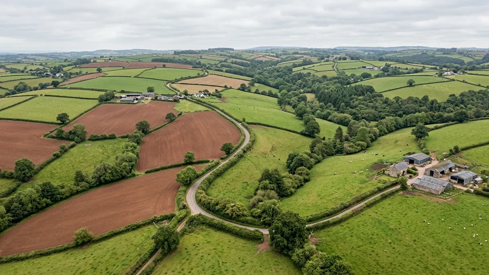
Aerial survey either side of the Tamar in east Cornwall, high open farmland with big holdings, industrial ground by the trunk road and weather off two moors.
Weather off two moors at once
This town sits high, catching weather that has come over Bodmin Moor from the west and Dartmoor from the east. Wind-driven rain from the south-west is the defining condition through the winter and there is very little shelter anywhere on the surrounding high ground.
For survey work that means fewer usable days than the Somerset or Dorset ground on this list and a need to take the weather when it comes. Larger holdings get planned as two visits from the start rather than optimistically as one.
Big holdings on the Cornish side
The farms west of the river run large, with substantial arable and dairy units and field parcels to match. That is efficient ground to fly in one sense, because a big level field covers quickly, and demanding in another, because a whole holding is a lot of flying and a lot of driving between blocks.
The quote reflects the actual shape of the holding rather than a rate per acre. Where the parcels are scattered, the day is planned around the driving; where they are contiguous, most of the day is flying.
The valley below the town
The ground falls away sharply from the hilltop into the valley below, and holdings that span both need planning by height band rather than as a single sheet. The same applies to anything running down to the Tamar itself.
River ground brings its own questions: bank condition, erosion, where a fence has been undercut, what the last flood left behind. All of that captures well, with the water surface itself recorded as a gap rather than modelled.
Trunk road ground and industrial units
The flatter ground by the main road carries industrial units, yards and haulage operations, and that produces the site work rather than the land work: compounds to record, surfaces to compare, material moving through a yard, access to capture before a contractor changes it.
It is the same underlying capture as a field, planned tighter and flown lower, with the report separating the yard from the land where a job covers both.
Travel, and what it does to the day
This is one of the longest runs from Exeter on the coverage list, and travel is inside the fixed price on every job here. What distance changes is how much fits into one visit.
So a survey out this way is planned to make the drive worth it: the whole holding in one go where the weather allows, or two blocks agreed in advance. What does not happen is a short visit that leaves half the job for another day at another fee.
Slate hanging, stone and what shows in a plan view
The exposed elevations in this town are hung with slate for a reason, and a capture that includes buildings shows that construction from an angle nobody normally gets: the hung faces, the ridges, the way the older roofs step down the slope in terraces.
It is worth saying again that this is a land survey and not a building inspection. Anything that needs assessing properly gets pointed at the site in this group built for that work, with the frames from this capture attached so whoever picks it up starts with a picture rather than a description.
Behind the survey
What Launceston clients are actually buying
Registered operator
CAA registered, with an Operator ID and a Flyer ID held. Both are checkable, and any land agent or consultant is welcome to ask for them before a flight is booked.
A2 Certificate of Competency
The A2 CofC, which is what governs how close the aircraft may work to people who are not part of the job. No GVC is held, so operations are planned inside the A2 CofC.
Aircraft
A DJI Mavic 4 Pro carrying a 100 megapixel Hasselblad camera and 6K video, and a DJI Mavic 2 Enterprise Advanced with a 640 by 512 radiometric thermal camera.
Insurance
Insured with Coverdrone for commercial operations. A certificate goes to your office before the visit if your site induction needs one on file.
Nearby
Also covered around Launceston
- HolsworthyAerial survey across the Culm Measures plateau of north-west Devon, big farm country where heavy clay makes winter ground access poor and the wind rarely stops.
- TavistockAerial survey in the Tavy and Tamar valleys, mining country where spoil, shafts and leats make ground far better looked at from above than walked over.
- LiskeardAerial survey between Bodmin Moor and the south Cornish coast, granite and renewables country where turbines and high open ground shape the flight plan.
Tell us the output you need
Request a quote in Launceston
Send the address and what is worrying you. Sam Hembury will come back with a fixed price and the next slot that suits the weather.