Devon · PL21
Aerial survey of land and sites around Ivybridge
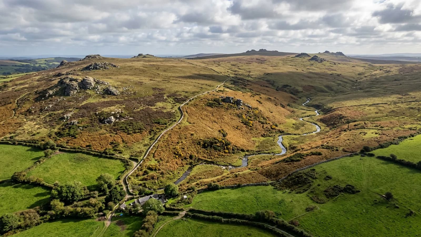
Aerial survey on the southern edge of Dartmoor, where wind funnelled down the Erme valley and the line between moor and enclosed land shape every flight.
Wind down a valley is not the wind in the forecast
The moor drops steeply to the South Hams here and the Erme runs out of it through a valley that funnels and gusts. A forecast figure taken for the district is close to useless on that ground: what matters is what the air is doing at survey height above a particular slope on a particular afternoon.
The tell is gusting rather than steady wind. A steady breeze at the top of the aircraft's range is workable; the same average made up of lulls and hard gusts is not, because the aircraft is fighting to hold station and the frames stop overlapping the way the plan assumed. On this ground that judgement is made on site.
Where enclosed land meets open moor
The boundary between the enclosed fields and the open moor is the feature most often wanted here, and it is a genuine one on the ground: a wall, a bank, a change in vegetation, sometimes all three and sometimes none of them.
From above that line reads clearly, which is exactly why people ask for it. What the survey provides is a dated, measurable picture of where the physical boundary sits. Where it corresponds to a legal boundary is a question for somebody qualified to answer it, and this survey does not pretend to.
Steep ground in a short horizontal distance
The northern side of the town sits noticeably higher than the southern side, and holdings that run up towards the moor gain a lot of height quickly. A plan flown level over that gets progressively closer to the ground as it climbs.
Splitting the parcel by height band solves it and costs a little more flying time. On the steepest ground it is also the safe answer rather than merely the tidy one, which is why it is decided at planning rather than adjusted in the field.
Rain and the length of the working day
Rainfall on the moor edge is high and the wet spells are long. Between November and February a usable day can be a few hours rather than a whole one, and the flight has to fit inside the window rather than the window accommodating the flight.
Larger holdings here are therefore often planned as two visits from the outset. That is said in the quote, not discovered halfway through the first afternoon when the light goes.
Modern estates, and the ground between them
This is largely a late twentieth century town, and the ground that gets surveyed around it is often the space between the estates: drainage corridors, wooded strips, verges, attenuation ponds, land held by nobody in particular until a question arises about it.
Those parcels are small, awkward and well suited to aerial capture, because walking them proves very little and one flight shows how they actually connect, where water goes and what condition the access is in.
The viaduct, the railway and other linear ground
The main line and its structures run across this valley, and infrastructure of that kind is corridor work: flown as a strip along the alignment with overlap down its length and enough width to carry the embankments, cuttings and drainage either side.
Anything near an operating railway needs the operator's agreement and a plan that keeps the aircraft clear, which is a conversation to have before a date is offered. Vegetation on cuttings and embankments is one of the most common reasons this sort of capture is asked for, and it is a subject that reads far better from above than from a lineside walk.
Behind the survey
What Ivybridge clients are actually buying
Registered operator
CAA registered, with an Operator ID and a Flyer ID held. Both are checkable, and any land agent or consultant is welcome to ask for them before a flight is booked.
A2 Certificate of Competency
The A2 CofC, which is what governs how close the aircraft may work to people who are not part of the job. No GVC is held, so operations are planned inside the A2 CofC.
Aircraft
A DJI Mavic 4 Pro carrying a 100 megapixel Hasselblad camera and 6K video, and a DJI Mavic 2 Enterprise Advanced with a 640 by 512 radiometric thermal camera.
Insurance
Insured with Coverdrone for commercial operations. A certificate goes to your office before the visit if your site induction needs one on file.
Nearby
Also covered around Ivybridge
- TotnesAerial survey across the South Hams around Totnes, estate and tenanted farmland on the tidal Dart, where a holding is usually several parcels in several hands.
- TavistockAerial survey in the Tavy and Tamar valleys, mining country where spoil, shafts and leats make ground far better looked at from above than walked over.
Tell us the output you need
Request a quote in Ivybridge
Send the address and what is worrying you. Sam Hembury will come back with a fixed price and the next slot that suits the weather.